Climate change bringing sea-level rise to Victoria’s low-lying towns and suburbs
 Rising sea, erosion to wreak havoc in low-lying suburbs: report, The Age , By Benjamin Preiss and Adam Carey
Other places at risk include areas around Queenscliff and Barwon Heads on the Bellarine Peninsula; the south-west Victorian towns of Port Fairy and Portland; and Tooradin, Lang Lang and Seaspray in the state’s south-east.
A report tabled in Victoria’s Parliament last week examines the myriad threats to the state’s fragile coastline, painting an alarming picture of damage to the environment and suburban Melbourne if no action is taken.
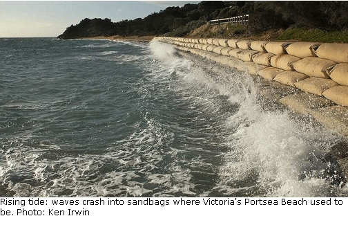
The Victorian Environmental Assessment Council report cites a 20-centimetre sea-level rise by 2040 and between 40 centimetres and one metre by century’s end.
Sea-level rise will lead to more frequent inundation of low-lying areas, loss of coastal habitat, cliff, beach and foreshore erosion,” the report says.
“Climate change will also put pressure on ageing coastal infrastructure and ultimately impact on feasibility of living in or developing some coastal locations.”
Increasing storm intensity, coupled with rising seas, will cause extensive erosion of the Victorian coastline by 2040, the report says.
“The most extensive area vulnerable to erosion by 2040 is the Gippsland coast,” it says. “Other coasts at risk include west of Portland, beaches in Port Phillip Bay between Mordialloc and Frankston, and the coast between Cape Paterson and Cape Liptrap in South Gippsland.”
No comments yet.
1 This month.

PETITION – To: Prime Minister Anthony Albanese and the Australian Labor Government
Chernobyl: The Lost Tapes – A good documentary on Chernobyl on SBS available On Demand for the next 3 weeks– https://www.sbs.com.au/ondemand/tv-program/chernobyl-the-lost-tapes/235274195556
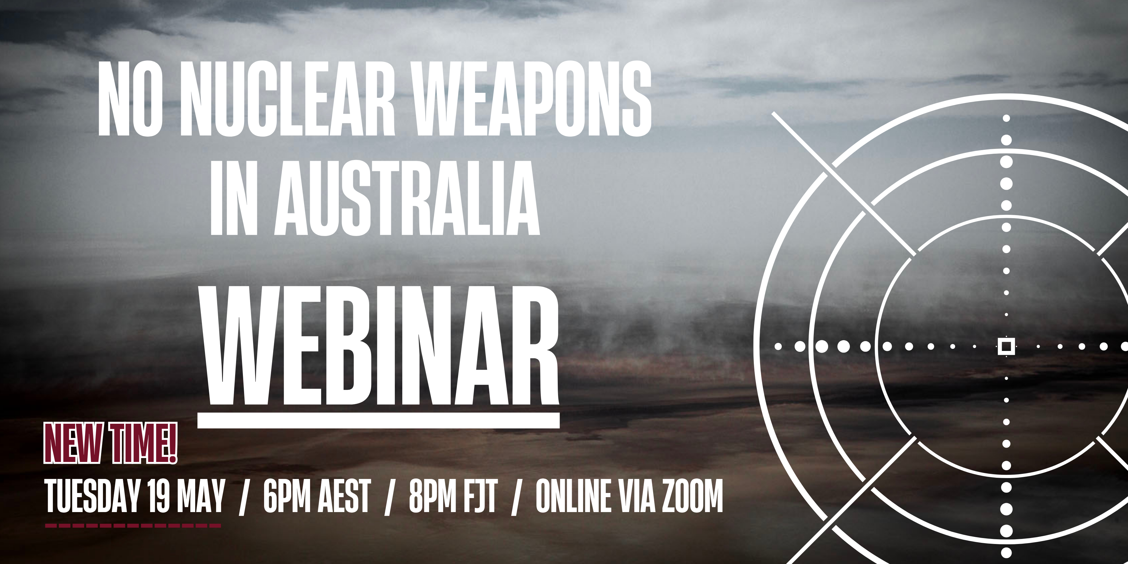
19 May – Webinar- Webinar: No Nuclear Weapons in Australia
Start: 2026-05-19 18:00:00 UTC Canberra, Melbourne, Sydney (GMT+10:00)
End: 2026-05-19 19:30:00 UTC Canberra, Melbourne, Sydney (GMT+10:00)
20 May – Webinar – The dangerous world of AUKUS, US, military occupation and suppression of dissent

National Webinar, 20th May, 2026, 6.30pm AEST. Confronting laws restricting/suppressing protest speech and action
Speakers: Former Sen. Rex Patrick, Lawyer Nick Hanna ,Arthur Rorris ,Jorgen Doyle, Sen David Shoebbridge,
Facilitator Kelley Tranter.

of the week – Australians for War Powers Reform (AWPR)
To see nuclear-related stories in greater depth and intensity

Leave a comment