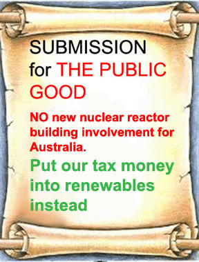
Keep Australia’s nuclear prohibition laws: it appears that nuclear is no part of climate action, not necessary

The most important group of nuclear power advocates who have consistently promoted concerns about climate change as the main reason for their advocacy have been the self-described ‘eco-modernists’. The main organizational focus of ecomodernism is the
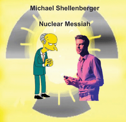 Breakthrough Institute, established by Michael Shellenberger and Ted Nordhaus in 2003.
Darebin Council, Melbourne – a world first on Climate Emergency
 This Melbourne council declared the world’s first climate emergency – now 28 countries are on board, Local and national governments in 28 countries have declared climate emergencies since Melbourne’s Darebin Council in 2016. Many now hope after this summer’s bushfires, Australia may declare a national emergency. SBS, BY EVAN YOUNG 1 Mar 20, On 5 December 2016, Melbourne’s Darebin Council made history.
Councillor Trent McCarthy put forward a motion that the council vote on declaring a state of climate emergency.
Though it would be merely symbolic, it was thought a declaration could still have practical use.
“Before the vote, residents were very much telling us climate change mattered more than anything else to them,” Darebin Mayor Susan Rennie told SBS News……..
Since 2016, Ms Rennie said Darebin Council has begun work on a number of green initiatives, including programs to subsidise solar panels for residents and businesses, working to make all council operations carbon-neutral, introducing a food waste recycling program and resurfacing roads with recycled material.
Making the declaration in 2016 “set the council on a path” to develop a climate plan, she said.
“Staff in all different parts of the organisation understand that looking at their work through the lens of a climate emergency is critical and it’s a core part of their jobs.”
“Our community expects action … so we also invite them to be much more vocal in what responses they want to see.”……
Where have climate emergencies been declared?
Ninety-four Australian jurisdictions have declared a climate emergency, according to Climate Emergency Declaration and Mobilisation in Action (CEDMA).
The ACT parliament declared a climate emergency in May 2019, becoming the first Australian state or territory to do so, while South Australia’s Upper House followed suit four months later.
More than 800 million citizens across 28 countries are estimated to live in jurisdictions that have declared climate emergencies, according to CEDMA.
Britain, France, Portugal and Argentina are among the national governments to make climate emergency declarations.
Pope Francis also made a declaration in June 2019, while in November, more than 11,000 scientists around the world signed a scientific paper stating that the planet was facing a climate emergency, “clearly and unequivocally”.
Could Australia declare a national climate emergency?
In October 2019, an e-petition calling on the federal government to declare a national climate emergency reached a record-breaking 404,538 signatures.
It received more than three times the number of signatures on a petition which held the previous record, calling for the removal of GST on menstrual products.
The same month, Greens MP Adam Bandt brought a vote to the House of Representatives on whether to declare a national climate emergency. His motion was defeated 72-65, with Emissions Reduction Minister Angus Taylor labelling it a “grand symbolic gesture”…….HTTPS://WWW.SBS.COM.AU/NEWS/THIS-MELBOURNE-COUNCIL-DECLARED-THE-WORLD-S-FIRST-CLIMATE-EMERGENCY-NOW-28-COUNTRIES-ARE-ON-BOARD
In Victoria the goal of the nuclear lobby is to remove Victoria’s Nuclear Activities (Prohibitions) Act
Nuclear lobby takes aim at Victoria to tackle prohibitions, Michael West Media, by Noel Wauchope | Feb 26, 2020 Having dithered on real action to tackle global warming, some in the Coalition are now taking a keen interest in solving it — by going nuclear. Noel Wauchope investigates what’s behind the sudden push to overturn legislation prohibiting the exploration and mining of thorium and uranium and puts a definitive case against a nuclear industry in Australia.
A batch of Coalition MP’s are pushing nuclear power as Australia’s answer to climate change. The group includes Katie Allen inner-city Melbourne Liberal, Ted O’Brien, Queensland LNP, Trent Zimmerman, North Sydney Liberal, Bridget Archer Tasmanian Liberal, David Gillespie Nationals NSW, Rick Wilson West Australian Liberal, and Keith Pitt, LNP from North Queensland, who was this week promoted to cabinet as Resources Minister. Former deputy prime minister and Nationals leader, Barnaby Joyce, is also a staunch proponent of nuclear power.
Arguing that nuclear power is the answer to bushfires and a heating climate when these are conversely nuclear’s greatest threat is akin to an argument by the Mad Hatter and the March Hare. The US National Academies Press compiled a lengthy and comprehensive report on risks of transporting nuclear wastes. They concluded that among various risks, the most serious and significant is fire. And indeed, climate change, in general, carries serious threats to nuclear reactors and the entire nuclear fuel chain.
But any port in a storm when you’re trying to sell a product that is expensive, unpopular, illegal in Australia and has the problem of long-lasting toxic wastes.
The Australian public’s renewed enthusiasm for action on climate change was timely. The nuclear lobby had, coincidentally already geared itself up for a campaign to overturn Australia’s State and Federal nuclear prohibition laws. The current Victorian inquiry is the latest in a spate of Parliamentary Inquiries aimed at removing these laws. Submissions are due by this Friday, 28 February.
The Inquiry’s Terms of Reference (TOR) are narrow:……..
It is clear the goal is to remove Victoria’s Nuclear Activities (Prohibitions) Act 1983. The very first TOR makes the mining of uranium and thorium as the prime concern. Given Victoria could run a nuclear power station with uranium/thorium sourced from elsewhere, it is clear that, after years of pressure by thorium lobbyists, the underlying goal of this inquiry is to overturn the legislation prohibiting the exploration and mining of thorium and uranium in Victoria.
The Victorian legislation was brought in to protect this State’s precious agricultural land and iconic ocean coast from polluting mining industries. South Gippsland is particularly rich in thorium.
Nuclear lobby tries to water down Victorian prohibition
The Terms of Reference are overtly biased: with no qualification, they promote the nuclear industry as undoubtedly beneficial to Victoria. This is ludicrous, as the global nuclear industry is in a state of decline.
Meanwhile, the renewable energy technologies of wind, solar and storage are now recognised by CSIRO and the Australian Energy Market Operator as, by far, the cheapest form of low carbon options for Australia, and are likely to dominate the global energy mix in coming decades
This first Term of Reference assumes that the “exploration and production” will result in nuclear power plants for Victoria, otherwise why do it? It also assumes that nuclear power will be effective in lowering C02 emissions.
However, there is no point in this “exploration and production” as it has been repeatedly demonstrated that nuclear power is no solution to climate change as in Dr. Paul Dorfman et al’s response to James Hansen on 20 December 2019 in the Financial Times.…….
The Terms of Reference are overtly biased: with no qualification, they promote the nuclear industry as undoubtedly beneficial to Victoria. This is ludicrous, as the global nuclear industry is in a state of decline.
Meanwhile, the renewable energy technologies of wind, solar and storage are now recognised by CSIRO and the Australian Energy Market Operator as, by far, the cheapest form of low carbon options for Australia, and are likely to dominate the global energy mix in coming decades
This first Term of Reference assumes that the “exploration and production” will result in nuclear power plants for Victoria, otherwise why do it? It also assumes that nuclear power will be effective in lowering C02 emissions.
However, there is no point in this “exploration and production” as it has been repeatedly demonstrated that nuclear power is no solution to climate change as in Dr. Paul Dorfman et al’s response to James Hansen on 20 December 2019 in the Financial Times.……… .https://www.michaelwest.com.au/nuclear-lobby-takes-aim-at-victoria-to-tackle-prohibitions/
How would nuclear benefit Victoria?
|
Nuclear lobby takes aim at Victoria to tackle prohibitions, Michael West Media, by Noel Wauchope | Feb 26, 2020 “…………..The Terms if Reference ask for the “economic, environmental, and social benefits to Victoria.” Victoria is moving towards a renewable energy revolution, with a significant uptake of renewable technology by the State Government. Victoria has set a renewable energy target of 50% by 2030 and Melbourne’s iconic tram network is to be powered by solar energy. The Norwegian Radiation Protection Authority (NRPA) revealed that thorium-based nuclear energy plants – once vaunted as a clean alternative type of nuclear energy – is not an environmentally safe alternative. Thorium leads to highly radioactive nuclear waste. Consequently, the risk of accidents will always be present the report said. Uranium mining has widespread effects, contaminating the environment with radioactive dust, radon gas, water-borne toxins, and increased levels of background radiation. As to the “social benefits”, the introduction of any part of the nuclear fuel chain into Victoria would particularly impact rural Victorians. The effect on tourism and farming industries has not yet been adequatley analysed, whereas solar and wind technologies can be developed alongside agriculture and tourism. Economist John Quiggin told Michael West Media last week that he’d support the removal of Australia’s ban in exchange for the establishment of a carbon price. Quiggin believes that this would put the nuclear proponents on the spot and open up the subject of the poor economics of the nuclear industry. You can read Quiggin’s submission here. This Victorian Parliamentary Inquiry may not succeed in promoting the thorium or the pro nuclear cause. However, it is part of what looks to be a co-ordinated national attack on nuclear prohibition laws. The mainstream media, particularly the Murdoch press, seems to toe the nuclear industry line that the way to fix global warming is to go nuclear. This Victorian Parliamentary Inquiry may not succeed in promoting the thorium or the pro nuclear cause. However, it is part of what looks to be a co-ordinated national attack on nuclear prohibition laws. The mainstream media, particularly the Murdoch press, seems to toe the nuclear industry line that the way to fix global warming is to go nuclear. Nuclear power is not supported by either Labor or the Greens.https://www.michaelwest.com.au/nuclear-lobby-takes-aim-at-victoria-to-tackle-prohibitions/ |
|
Frank Simpson warns against the pollution of Victoria’s agricultural land by thorium/uranium mining
 Risk in contaminating a prime green food producing region of Victoria. (3) This implies all stages of the fuel cycle from exploration to waste repository storage.
143 Anti-Nuclear, 10 Pro Nuclear Submissions (published) to Victorian Parliament
Submissions published so far to the Victorian Government’s Inquiry into Nuclear Prohibition are running strongly ANTI NUCLEAR https://www.parliament.vic.gov.au/epc-lc/article/4348
There are currently 143 submissions opposing the nuclear industry.
There are 10 submissions favouring the nuclear industry. (You can bet that vested interests have sent in confidential submissions)
![]() PRO nuclear
PRO nuclear
1. Don Hampshire ( with attack on ABC, The Age )
2 Robert Heron – vaguely
3 Terje- Petesen
116 Leah McDermott
122 Simon Brink
123 CFMMEU Mining and Energy Division 21 Azark 26 Buchanan, Bill 27 Murphy, Barry 28 Patterson, John
ANTI nuclear
 4 Jessica Lawson 5 Pro Forma list of 122 contributors 48 Janet Nixon 49 Karen Furniss 63 Graeme Tyschsen 68 Barbara Devine 76 Vivien Smith
77 Lachlan Dow 81 RVS Industries 92 Alan Hewett and Joan Jones 103 Anne Wharton 106 John Quiggin vague 107 Amy Butcher 109 Nick Pastalatzis 112 Philip White 22 Friends of the Earth 23 Derek Abbott 24 Simpson, Frank 25 Wauchope, Noel 29 Wissink, Bart 30 Sharp, Robyn 31, Smith, Colin
Philip White shows folly of nuclear activities for Victoria: Submission No.112
Submission 112 Philip White to Victorian govt INQUIRY INTO NUCLEAR PROHIBITION
A very brief summary of conclusions that can be drawn from the attached submission with respect
to each of your inquiry’s terms of reference are as follows:
(1)investigate the potential for Victoria to contribute to global low carbon dioxide energy production through enabling exploration and production of uranium and thorium The notion that nuclear energy is low carbon is superficial. A deeper analysis shows that nuclear energy is an obstacle to realisation of a low carbon economy (refer “c. environmental
impacts” in the attached submission). Hence the idea that uranium and thorium exploration and production could make a useful contribution to global low carbon
dioxide energy production is mistaken.
(2) identify economic, environmental and social benefits for Victoria, including those related to medicine, scientific research, exploration and mining.
Nuclear energy related facilities tend to create host communities which are economically dependent
on these facilities and which are therefore under huge pressure to overlook the safety and environmental risks associated with these facilities (refer “b. health and safety” in the attached submission). The safest approach is not to build these facilities in the first place. (I assume the phrase “including those related to medicine, scientific research, exploration and mining” is not meant to exclude nuclear power plants and other aspects of the nuclear fuel cycle.) It is doubtful whether exploration and mining could generate significant
economic benefits given that the long‐term prospects for nuclear energy are so uncertain. Refer
The World Nuclear Industry Status Report 2019: https://www.worldnuclearreport.org/WNISR2019‐Assesses‐Climate‐Changeand‐the‐Nuclear‐Power‐Option.html
(3) identify opportunities for Victoria to participate in the nuclear fuel cycle The attached submission provides many reasons why it would be unwise for
Victoria to participate in the nuclear fuel cycle.
(4) identify any barriers to participation, including limitations caused by federal or local laws
and regulations.
There are many legitimate barriers to nuclear fuel cycle activities, including safety, environmental protection, non‐ proliferation concerns and lack of public acceptance, but ultimately the barrier that is most likely to
stick is that nuclear energy is not economically viable (refer “d. energy affordability and reliability and economic feasibility” in the attached submission- below).
Submission to the Inquiry into the Prerequisites for Nuclear Energy in Australia …….
For reasons outlined below, nuclear energy is not and will not in the foreseeable future be a desirable option to supply Australia’s energy needs. The specific terms of reference are addressed below, with particular attention to issues and perspectives that proponents of nuclear energy are inclined to neglect or downplay:
a. waste management, transport and storage ………
b. health and safety ……
c. environmental impacts …….
d. energy affordability and reliability, and e. economic feasibility …….
f. community engagement and i. national consensus ……..
g. workforce capability …….
h. security implications ……
j. any other relevant matter
Based on the above analysis, it would be unwise for Australia to embark on a nuclear energy program and it is very sensible to declare this in the clearest possible terms. In this regard, I am encouraged to see in the Terms of Reference for this inquiry the statement that “Australia’s bipartisan moratorium on nuclear energy will remain in place.” https://www.parliament.vic.gov.au/epc-lc/article/4348
SUBMISSIONS 122 Australians want Victoria’s Nuclear Prohibition Laws to stay
Unlawful and unpopular: Nuclear power and nuclear reactors are prohibited under existing federal, state and territory laws. The nuclear sector is highly contested and does not enjoy broad political, stakeholder or community support.
Disproportionate impacts: The nuclear industry has a history of adverse impacts on Aboriginal communities, lands and waters.
SUBMISSION TO VICTORIAN PARLIAMENT INQUIRY INTO NUCLEAR PROHIBITION
Jessica Lawson and 122 others (list is available) Dear Standing Committee on Environment and Planning,
Victoria’s Nuclear prohibition laws Inquiry – these are the Committee Members
The members of the Environment and Planning Committee are:
Cesar Melhem (Chair)
Clifford Hayes (Deputy Chair)
Bruce Atkinson
Melina Bath
Jeff Bourman
David Limbrick
Andy Meddick
Samantha Ratnam
Nina Taylor
Sonja Terpstra
The participating members of the Committee are:
David Davis
Georgie Crozier
Catherine Cumming
Tim Quilty
Bev McArthur
If you would like any further details on the Committee members or the Inquiry please see: https://www.parliament.vic.gov.au/epc-lc/inquiries/inquiry/983
Victorian govt Nuclear Inquiry – published Submissions
First published results on the Inquiry website are strongly ANTI-NUCLEAR. But we must remember that there could be many confidential submissions, that we don’t know about.
PRO nuclear
1. Don Hampshire
2 Robert Heron – vaguely
3 Terje- Petesen
116 Leah McDermott
122 Simon Brink
123 CFMMEU Mining and Energy Division
ANTI nuclear
4 Jessica Lawson
5 Pro Forma list of 122 contributors probably anti-nuclear
48 Jaznet Nixon 49 Karen Furniss
63 Graeme Tyschsen
68 Barbara Devine
76 Vivien Smith
77 Lachklan Dow
81 RVS Industries
92 Alan Hewett and Joan Jones
103 Anne Wharton
106 John Quiggin vague
107 Amy Butcher
109 Nick Pastalatzis
112 Philip White
see https://www.parliament.vic.gov.au/epc-lc/article/4348 -to read the submissions
Submission to INQUIRY INTO NUCLEAR PROHIBITION (focussing on thorium etc)

Submission to INQUIRY INTO NUCLEAR PROHIBITION
Introduction
I read the very narrow Terms of Reference (TOR) with some amazement. It is certainly made clear that the goal is to remove Victoria’s Nuclear Activities (Prohibitions) Act 1983 (1)
The very first TOR makes the mining of uranium and thorium as the prime concern. After all, Victoria could presumably have nuclear power with these minerals sourced from elsewhere. I conclude that the underlying goal of this Inquiry is, under the relentless pressure of thorium lobbyists such as John White, indeed to remove that legislation, which effectively prohibits the exploration and mining of thorium and uranium in Victoria. John White has a long history of promotion of the nuclear industry (2), and previously owned the massive 3,700 sq km mining exploration lease EL4416 [picture attached] right across Southern Gippsland’s prime coastal and tourism region, and runs the entire length of the spectacular 90 Mile Beach.(3)
Clearly, the Victorian legislation was brought in to protect this State’s precious agricultural land, and iconic ocean coast from polluting mining industries.[picture attached]
The Terms of Reference are clearly biased: with no qualification they promote the nuclear industry as undoubtedly beneficial to Victoria. This is ludicrous, as the global nuclear industry is in a state of decline (4)
Meanwhile, renewable energy technologies, wind, solar and storage are now recognised by CSIRO and the Australian Energy Market Operator as by far the cheapest form of low carbon options for Australia, and are likely to dominate the global energy mix in coming decades. (5)
- https://en.wikipedia.org/wiki/Uranium_Council
- https://independentaustralia.net/environment/environment-display/ia-investigation-victoria-goes-dirty-brown,3788
- https://www.fool.ca/2020/01/31/the-death-knell-for-nuclear-and-the-end-of-cameco-tsxcco/
- https://reneweconomy.com.au/new-csiro-aemo-study-confirms-wind-solar-and-storage-beat-coal-gas-and-nuclear-57530/
on potential benefits to Victoria in removing prohibitions enacted by the Nuclear Activities (Prohibitions) Act 1983
Now, turning to each TOR
(1) investigate the potential for Victoria to contribute to global low carbon dioxide energy production enabling exploration and production of uranium and thorium; through enabling exploration and production of uranium and thorium.
Nuclear power is no solution to climate change. This Term of Reference assumes that the “exploration and production” will result in nuclear power plants for Victoria, otherwise why do it? It also assumes that nuclear power will be effective in lowering C02 emissions.
But there is no point in this “exploration and production” as it has been repeatedly demonstrated that nuclear power is no solution to climate change.
Even if nuclear power really could combat climate change, it would take decades to get enough reactors in operation. It would be too late, whereas renewable energy, solar and wind, and also energy effiiciency strategies, can be set up quickly. This means that to establish nuclear power would be counter-productive, as time, energy, and money would be diverted away from those genuine solutions. Dr Paul Dorfman, et al (6)
Nuclear power is vulnerable to climate change. Increasing temperatures can result in reduced nuclear reactor efficiency by directly impacting nuclear equipment or warming the plant’s source of cooling water. (7) Nuclear power is uniquely vulnerable to increasing temperatures because of its reliance on cooling water to ensure operational safety within the core and spent fuel storage. As the most water-intensive energy generation technology, (8) nuclear reactors are located near a river or the ocean to accommodate hefty water usage, which averages between 1,101 gallons per megawatt of electricity produced to 44,350 gal/MWh depending on the cooling technology.
Inland reactors that use rivers as a source for cooling water are the most at risk during heat waves, which according to the Intergovernmental Panel on Climate Change (IPCC) are “very likely” to occur more often and last longer in the coming decades. (9)
Especially Australian climate impacts on nuclear technology. In view of Australia’s bushfire crisis, it just seems ludicrous that anyone would contemplate introducing nuclear power technology of any type to this country. The Lucas Heights research nuclear reactor is already enough of a worry. Bushfires have occurred in its vicinity.(10) The transport of nuclear wastes would be threatened by bushfires (11)
Nuclear power would place an intolerable burden on Australia’s precious, but limited water supply. Nuclear power plants require huge amounts of water to prevent fission products in the core and spent nuclear fuel from overheating (incidentally making nuclear the most water intensive energy source in terms of consumption and withdrawal per unit of energy delivered).
Uranium mining and nuclear facilities are highly water intensive, while solar and wind power can alleviate water stress. (12)
Why thorium exploration and production? Thorium nuclear reactors do not exist yet, and quite possibly never will. Thorium itself is not a fissile material. It can only be transformed into fissile uranium-233 using breeder and reprocessing technology. Its development entails a complex processes, bringing risks of weapons proliferation and smaller but highly toxic, amounts of long-lasting radioactive wastes. After reaction, the thorium blend leaves dangerous wastes like U-232, a potent high-energy gamma emitter that can penetrate one meter of concrete and will have to be kept safely out of our air, food, and water forever. (13)
In January, the Climate Council ‒ comprising Australia’s leading climate scientists and other policy experts ‒ issued a policy statement, noting that nuclear power plants “are not appropriate for Australia – and probably never will be” as they are “a more expensive source of power than renewable energy, and present significant challenges in terms of the storage and transport of nuclear waste, and use of water”.(14)
- https://medium.com/@albertbates/john-wayne-squares-off-against-jim-hansen-42a258b2260d
- The Effect of Rising Ambient Temperature on Nuclear Power Plants http://large.stanford.edu/courses/2018/ph241/duboc1/
- https://theatlas.com/charts/H1scYH_H7
- Future Climate Changes, Risks and Impacts https://ar5-syr.ipcc.ch/topic_futurechanges.php
- https://www.smh.com.au/national/nsw/residents-warned-not-to-leave-sydney-fire-worsens-20180415-p4z9os.html
- https://independentaustralia.net/environment/environment-display/transporting-nuclear-wastes-across-australia-in-the-age-of-bushfires,13465
- https://www.businesstimes.com.sg/energy-commodities/solar-wind-power-can-alleviate-water-stress
- Thorium ‒ a better fuel for nuclear technology? Nuclear Monitor, by Dr. Rainer Moormann
- https://www.climatecouncil.org.au/resources/godfather-of-australian-science-warns-government/
(2) identify economic, environmental and social benefits for Victoria, including those related to medicine, scientific research, exploration and mining;
Economic benefits? Victoria is right now on the cusp of a renewable energy revolution, with all sorts of exciting developments, for example, Melbourne’s iconic tram network to be powered by solar energy. (15) Victoria has a renewable energy target of 50% by 2030. (16) Why imperil that progressive transition to clean energy, by the distraction of the expensive and dirty industry, with its connection to nuclear weapons development?
In 2017–18, the state’s temperate climate, high quality soil and clean water helped the industry produce $14.9 billion worth of agricultural product from 11 million hectares. This makes Victoria Australia’s largest agriculture producer.(17). In Gippsland, John White’s Ignite Energy Resources holds a huge mining license, in an area with exceptional resources of monazite, a source of thorium.(18) the same area that is renowned for both its tourist attractions and its agriculture. Gippsland farms account for at least one quarter of Victoria’s milk, vegetable and beef production with a number of Gippsland’s businesses exporting food across the world (19)
Why would anyone in their right mind imperil Victoria’s successful and continuing agricultural and tourism industries for a gamble on a fantasy about thorium nuclear reactors? Those reactors are currently nonexistent, and likely to remain so.
The Australian nuclear hype focusses on “Generation IV” technologies, especially Small Modular Nuclear Reactors (SMRs – they leave out the unpopular word “nuclear”)
No-one wants to pay for SMRS
No company, utility, consortium or national government is seriously considering building the massive supply chain that is at the very essence of the concept of SMRs ‒ mass, modular factory construction. Yet without that supply chain, SMRs will be expensive curiosities.
Small nuclear reactors are not economically viable. The main priority preventing safe deployment [of small nuclear reactors] is economics. Most commercial proposals for SMRs involve cost-cutting measures, such as siting multiple reactors in close proximity. This increases the risk of accidents, or the impact of potential accidents on people nearby. (20)
The world wide effort by the nuclear industry to hype up small nuclear reactors is not resulting in any sign of success, given their disastrous economics, among other problems. (21)
Thorium and uranium mining? Given the decline in the nuclear power industry, and the glut in uranium, the uranium market is in permanent doldrums. (22)
Thorium nuclear reactors – there are many sources that detail the problems that make these reactors unlikely ever to become a commercial reality. They are in essence really uranium fuelled, as they require plutonium or enriched uranium to start the process. Their major problem is of course their very high cost. Other disadvantages, safety risks, toxic long-lasting wastes, weapons proliferation risks. (23)
Environmental benefits? Are they kidding? The environmental consequences of using thorium-based nuclear power will result in the same problems the world faces today with uranium bases reactors. (24)
Uranium mining has widespread effects, contaminating the environment with radioactive dust, radon gas, water-borne toxins, and increased levels of background radiation. (25) The industry’s use of water is huge, making it a very unwise industry for for water -scarce Australia.
Social benefits? What social benefits? The introduction of any part of the nuclear fuel chain into clean, green Victoria would bring conflict, division and distress especially to rural Victorians. All for the faint hope of riches for a few mining entrepreneurs, and the promise of jobs, jobs jobs in mining, an industry that is becoming increasingly and rapidly automated. The effect on the tourism and farming industry would be loss of jobs, whereas solar and wind technologies can be developed alongside agriculture, bringing many more jobs.
(3) identify opportunities for Victoria to participate in the nuclear fuel cycle; and
If the well-being of the farming and tourist communities is ignored, well, some enthusiastic nuclear entrepreneurs might be able to get hold of tax-payers’ money , and get their almost certainly futile dream started.
(4) identify any barriers to participation, including limitations caused by federal or local laws and regulations.
Apart from the barriers of extremely bad economic outlook for nuclear activities in Australia, apart from the environmental, health and safety risks, apart from damage to agriculture and tourism, -yes there are legal and regulatory hurdles for the nuclear lobby to overcome.
Victoria’s laws are not haphazard whims of a few latte-drinking tree huggers.
They have been developed to protect the public from the very sorts of dirty nuclear industries that are now being touted by the nuclear lobby
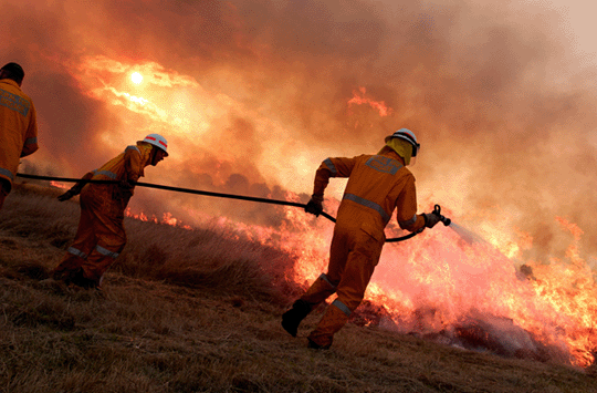
Massive fires merge across the New South Wales – Victoria border
Dry heat, shifting winds and powerful gusts fanned more than 100 blazes devouring drought-parched bushland throughout southern NSW overnight, as the East Ournie Creek and the Dunns Road fire zones came together north of Mount Kosciuszko on Friday evening, near the village of Tooma.
Meantime, the Morton fire in the Southern Highlands near Bundanoon was upgraded to emergency warning level about 1am on Saturday as north and north-westerly winds gave way to a strong southerly change. ……
North and north-westerly winds gave way to a southerly change overnight, which combined with merging fires, provided additional challenges from multiple entry points. Mr Clark said they were “expecting fires to potentially spread in two directions overnight”.
“What we’re really seeing with a number of these fires merging is a number of small fires started by lightning strikes, across the landscape. And as they grow, we see fires merging,” RFS spokesman Anthony Clark said.
“It provides a challenge for firefighters as when they merge, it increases the size and opens up more uncontained perimeter.”
Early on Saturday, more than 2500 firefighters were battling 147 blazes in NSW, as the bushfires crisis escalated across four states. More than 60 of those NSW fires were uncontained.
Residents were also fleeing fire fronts tearing through parts of eastern Victoria and Kangaroo Island off South Australia, where crews faced rising winds, bone-dry bushland and blistering temperatures. Also homes in Perth were under threat…….
Winds gusting up to 90km/h swept through the state later in the evening. Temperatures soared past 40 degrees in inland areas, while the RFS warned large blazes in the south-east could spread under worsening conditions, or shoot off embers that might create spot fires.
The blustery conditions were expected to bring mixed fortunes for firefighters overnight – dropping temperatures on the ground while making blazes more unpredictable after dark…… https://www.smh.com.au/national/nsw/fires-on-the-nsw-and-victorian-border-likely-to-merge-as-winds-worsen-20200110-p53qby.html
Mega fire set to form as ‘frustrated’ authorities plead with ‘stubborn’ residents
 Mega fire set to form as ‘frustrated’ authorities plead with ‘stubborn’ residents— Yahoo News 6 Jan 2020
Residents in Victoria have been told a giant 180,000 hectare fire will join with out-of-control fires across the border in NSW to create a ‘mega fire’.
Exhausted firefighters worked tirelessly to contain the bushfires throughout the weekend but a powerful and volatile southerly on Saturday quickly stretched the blazes, with the fires edging closer to each other throughout Sunday.
And while rain has brought a brief period or respite, residents were told at a CFA meeting in Tallangatta on Sunday night it is only a matter of time before the Corryong fire connects with the huge 297,000-hectare Dunns Road fire around the Snowy Mountains, the ABC reported…….
‘Uncharted territory’ for NSW
Ms Berejiklian labelled the ongoing threat “uncharted territory” with hundreds of homes feared lost across southern NSW.
“We can’t pretend this is something we have experienced before – it’s not,” she told reporters on Sunday.
At 6am, there were 136 fires burning across NSW, with 69 uncontained.https://au.news.yahoo.com/mega-blaze-forming-nsw-victoria-border-500000-hectares-213253196.html
Evacuation of thousands as Victoria’s bushfires merge
 LIVE: Victorian fires merge, thousands told to leave as fire danger worsens, 9 News, By Olivana Smith Lathouris • Producer Dec 30, 2019 With temperatures set to soar, around 30,000 residents and holiday-makers have been urged to evacuate in Victoria’s far east as fires rip through East Gippsland.
– Firefighters expecting bushfire conditions in NSW to deteriorate with high temperatures and strong winds forecast in the lead-up to New Year’s Eve.
– Sydney’s NYE fireworks display is expected to go ahead but a final decision will be made later today…… https://www.9news.com.au/national/bushfires-near-me-live-coverage-victoria-nsw-residents-evacuated-ahead-of-catastrophic-fire-conditions/d2fd78c3-c1b4-46f9-adb7-ba2cf6d6a3b8
Victoria’s chemical waste scandal
|
White claimed it was a quad-biking course for his children, an answer that satisfied the curiosity of the council officer. But five years on, we know the truth. Covered by a thin layer of topsoil were the pits that White had dug and that he was filling with toxic waste — millions of litres of chemicals and tonnes of asbestos-contaminated products brought by the truckload. The Kaniva property was the final destination for an illegal dumping syndicate whose operations grew so large they distorted the national market in toxic waste disposal. Victoria’s Environment Protection Authority — relying on a paper-based tracking system and a lax inspection regime — was blindsided by this dark market that threatened public safety and the welfare of emergency services personnel. By the time the scheme was accidentally exposed in 2018, White and his associates at Bradbury Industrial Services had illicitly buried or stockpiled an estimated 50 million litres of highly flammable solvents and other toxic materials. The failure to arrest this operation also laid the groundwork that sparked two of Melbourne’s worst-ever industrial fires. The value propositionSome time after 2013, White made an informal arrangement with waste recycling and remediation company, Bradbury. Their pitch to the producers and owners of toxic waste was simple — we can do it cheaper. Industry sources who declined to be identified for fear of retribution by their employers say the waste industry operates on thin margins. The syndicate offered to dispose of products at up to half the cost of competitors. Sometimes they offered to transport chemicals from the factory door for free. An investigation by The Age has revealed that manufacturers, chemical companies, waste processors, and paint, automotive and cleaning businesses across the eastern states quickly signed up. …… https://www.theage.com.au/national/victoria/the-man-who-made-a-toxic-waste-disaster-20191205-p53h1x.html |
|
1 This month.
Australians deserve the truth
about
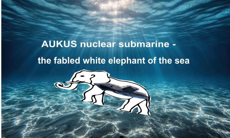
AUKUS – https://aukuspublicinquiry.com/
Australians deserve the truth
about AUKUS
7 June – WEBINAR- Get Inspired by Protests Against Military Bases!
Jun 7, 2026 12:00 AM in Canberra, Melbourne, Sydney


PETITION – To: Prime Minister Anthony Albanese and the Australian Labor Government

of the week – Australians for War Powers Reform (AWPR)
To see nuclear-related stories in greater depth and intensity
